Editor-in-Chief’s Note
After a tentative start during the first tenure of the Narendra Modi Government in 2014, major structural, functional and attitudinal reforms have been accelerated in India’s Ministry of Defence, starting from the appointment of the country’s first Chief of Defence Staff (CDS), creation of the Department of Military Affairs to corporatising the century-plus old Ordnance Factory Board (OFB) and improving ease of doing business in defence. The MoD under Defence Minister Rajnath Singh has carried far-reaching changes since 2019 in South Block that houses the top offices of the Ministry. This month in our special series, BharatShakti.in, brings you a series highlighting the major milestones in this ongoing journey that makes India’s defence sector one of the most sought-after the world over.
…………………………………………………………………………………………………………………….
Defence Ministry Accelerating Digital Transformation
Defence reforms have been undertaken in the year 2020 by the Ministry of Defence (MoD) to bring about greater cohesion and modernization of the Armed Forces through policy changes, innovation and digital transformation are gathering pace. A new sense of urgency is visible in the South Block Corridors. An important fallout is the cyber security policy for MoD LAN, unveiled to address security threats that will ensure all offices of the Ministry have more effective security.
For the first time, several organisations of the MoD went digital. Directorate General Quality Assurance (DGQA) started online Pre-Delivery inspection in May 2020 to address security threats. The Armed Forces Tribunal began digital hearing for the first time in August 2020. Defence Estates, Canteen Stores Department, Services in Cantonment, MoD Pension, National Defence College (NDC) and National Cadet Corps (NCC) also went online providing faster and transparent services.
The Defence Ministry set up an online portal ((https://rakshapension.desw.gov.in)) on 14 January this year to resolve pension-related grievances of ex-servicemen (ESM) and their dependents after implementing e-pension schemes enabling ease of access for the defence pensioners in 2020. There are more than 26 lakhs Armed Forces pensioners/family pensioners and approximately 55,000 pensioners are added every year.

Cantonment services – e-chhawani – was launched in 2021 for all 62 cantonments to provide e-services with simplified online trade license renewal. NOC for setting up infrastructural projects went digital in June 2020 to address security threats in the cantonments. Land management system to manage requests for transfer of defence land was also launched in 2020 to usher ease of doing business with defence.
Digital Mapping of Defence Land
Digital mapping of defence estate lands was the major initiative launched by the Ministry of Defence in 2018. MoD surveyed 17.78 lakh acres of defence land, one of the largest such land surveys, in a little over three years, using modern survey technologies.
Out of MoD’s 7.99 lakh acres, approximately 1.61 lakh acres is in the 62 notified Cantonments. About 16.38 lakh acres are spread across multiple pockets outside the Cantonments. Out of 16.38 lakh acres of land, about 18,000 acres is either state hired land or is proposed for deletion from records on account of transfer to other government departments.
Clear demarcation and boundary survey of defence lands and fixing of the boundaries is necessary for the protection of the defence land, safeguarding of the title of MoD, updation of land records, maps and prevention of encroachments. Towards this end, the Directorate General Defence Estates, MoD commenced the Survey of Defence Land in October 2018.
According to the official statement, the entire exercise of survey of about 1.61 lakh acres of defence land inside cantonments and 16.17 lakh acres outside cantonments (total 17.78 lakh acres) has been completed by using the latest surveying technology. Modern survey technologies like Electronic Total Station (ETS) and Differential Global Positioning System (DGPS) were used in the survey.
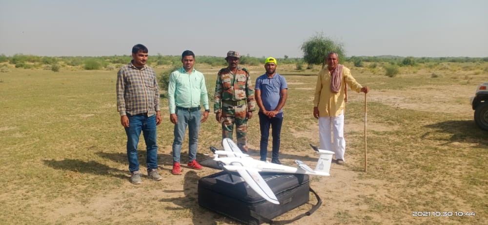
To further speed up the process, drone imagery and satellite imagery-based surveys were leveraged for reliable, robust and time-bound outcomes. 3D Modelling techniques for better visualisation of defence land in the hilly areas have also been introduced by utilising Digital Elevation Model (DEM) in association with Bhabha Atomic Research Centre (BARC), the statement stated.
Institutes like National Remote Sensing Centre and National Institute for Geo-Informatics Science and Technology helped in the conduct of the survey. A Centre of Excellence (CoE) on Land Survey and GIS mapping has also been established in NIDEM (National Institute of Defence Estates Management) for sharpening proficiecy of Defence Estates officials in the field of latest survey technologies by the MoD.
According to MoD, as a part of the survey, a project for a real-time change detection system based on the Time series Satellite imagery for detection of encroachments on defence land has also been initiated. A pilot test has been carried out on satellite imageries of defence land pockets procured from the National Remote Sensing Centre, Hyderabad. Geo-referenced and digitised shape-files are being made available to enable quick decision making by officials of DGDE and MoD.
The survey will eventually help in reducing boundary disputes amongst stakeholders and would also help in resolving legal disputes at various levels. Understandably, the mammoth exercise of survey of defence land is indeed an unique example of leveraging emerging technologies for land survey in consonance with the government’s resolve of Digital India push.
Ravi Shankar


